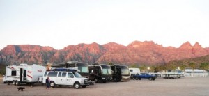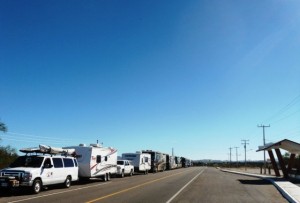
March 1, 2014 – Lots has happened since our full day in La Paz before continuing our journey north. Dom & Diane arrived with their group, they had decided the Cerritos Surf colony was overpriced and weather was crappy. Plus that they could spend more quality time at Carnaval which started the day we left for Puerto Escondido. Everyone really enjoyed their time in La Paz, a good look at the old town, the many shops, the Madero Mercado, the Malecon. Lisa also came with us and purchased fabric for our daughter’s wedding. Heather our youngest, is getting married in 2015 at our house. That evening we got together for a Happy Hour to say our goodbyes to Mike & Kelly who remain in La Paz for Carnaval. Dom & Diane joined us, we will see them again in Potrero in about 10 days.
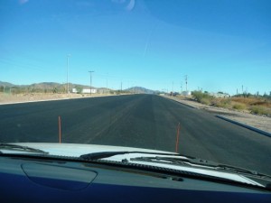
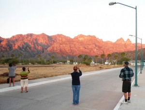
We departed for Puerto Escondido at 8am and it was apparent Amy was not feeling well, perhaps something she ate at lunch the day before. We encountered a couple of new sections of road construction, just north of Santa Rita and again east on Hwy 1 of Ciudad Insurgentes. Yes the Hwy 1 continues to improve with at least 8 sections under redevelopment and repaving this season! We arrived at our destination without incident, the gang was impressed with this marine facility, although they were puzzled (as we are) what exactly the larger development plan is. Some of the group joined us for dinner and then we headed off for the evening, the weather continues to be very warm with little or no wind.
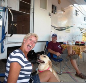
The next morning it was apparent that Amy was not getting better so journey north included a stop at the Loreto Medical Clinic. Within minutes of arriving at the emergency Amy was seen by an english speaking Mexican Doctor, in no time at all we were on our way, Amy had a prescription, some meds with instructions and satisfied that she would be feeling better in the near future, all for $450 pesos, about $35 US. Our drive included another significant section of road construction; it would appear the road widening that has been completed south of the Loreto arroyo will eventually each Puerto Escondido, wow! Ken & Bonnie dropped off during our stay in Loreto and returned to our friend Kathy’s shop, to make some additional purchases. Our drive to Mulege included being passed a couple of times by a convoy of Mexican Military, lots of waves and smiles as they went by. About an hour and a half after we got set up at the Hotel Serenidad we headed for town with lots of laundry for Ida, Ken & Bonnie arrived just prior to our departure and joined us. Made a trip out to the Lighthouse, the Loma Linda, the Orchard and the Oasis. We stopped had said chatted to Chris & Jeannie, also said hi to Penny & Jim who recently purchased a home on the Mulege River.
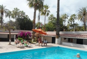
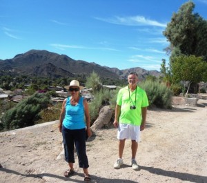
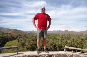
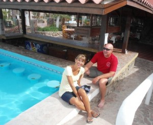
Today we headed back into Mulege for some more sighting seeing, a few more purchases and to pick up laundry. After dropping Lisa off at the Laundromat we climbed up the hill and onto the road leading to the local Museo, formerly the prison that closed in 1952. Back in the day they released the not so bad inmates who would return after a day’s work out in the community. It helped that there was no way out of town, long before the Hwy 1 was finished. No luck as it was not open, no volunteer I guess, too bad, always an interesting stop. Next off the Mission, the site was selected in 1701 by the Jesuits and completed in 1766 and this was open. After we trekked up to the viewpoint out back for a view of the Mulege Valley and the vast Palm Oasis. Returning to town the gang spread out for a few more bargains. After a spell we met at the Lavanderia collected everyone up and headed back to the Hotel Serenidad. Most of the afternoon was spent relaxing; some folks even hit the pool. Tonight most are having dinner at the hotel which is hosting the traditional Saturday Night Pig Roast. Tomorrow at 8:am we head north to Guerreo Negro and our last day in Baja Sur.
Did you know?
Geologic evidence widely interpreted by geologists has indicated the Gulf of California came into being around 5.3 million years ago as tectonic forces rifted the Baja California Peninsula off the North American Plate. As part of this process, the East Pacific Rise propagated up the middle of the Gulf along the seabed. This extension of the East Pacific Rise is often referred to as the Gulf of California Rift Zone. The Gulf would extend as far as Indio, California, except for the tremendous delta created by the Colorado River. This delta blocks the sea from flooding the Mexicali and Imperial Valleys. We know volcanism dominates the East Pacific Rise and as such the island of Isla Tortuga is one example of this ongoing volcanic activity.
A more common understanding is the Sea of Cortés(z) (also known as the Gulf of California or Vermilion Sea), is approximately 5 million years old, actually one of the youngest seas on earth. Locally known in the Spanish language as Mar de Cortés or Mar Bermejo or Golfo de California this body of water that separates the Baja California Peninsula from the Mexican mainland and was formed during an era of frequent volcanic activity and earthquakes of tremendous magnitude. During the period of time that volcanoes and the San Andreas Fault (running right down the very middle of the Sea of Cortez) were creating Baja they were also creating the great chasm that would eventually become the Sea of Cortez. Interesting enough many of the volcanic peaks broke off and fell into the chasm, later some became islands. The Gulf of California contains 37 islands – the two largest being Isla Ángel de la Guarda and Tiburón Island. It is bordered by the states of Baja California, Baja California Sur, Sonora, and Sinaloa with a coastline of approximately 4,000 km (2,500 mi). Rivers which flow into the Gulf of California include the Colorado, Fuerte, Mayo, Sinaloa, Sonora, and the Yaqui. The gulf’s surface area is about 160,000 km2 (62,000 sq mi).
Some of the earliest charts, drawn in the early 1500’s, depicted Baja as an island. This was disproven in 1539 by Francisco de Ulloa who was sent by Hernán Cortes to explore the area. Cortes had heard persistent rumors that there was an island ruled by Amazon women with weapons of made of gold and that the surrounding waters were paved with endless beds of pearls. Ulloa kindly named the sea after his benefactor.
Biologically speaking the Sea of Cortez is historically the richest body of water on our entire planet. This diverse sea has supported more than 900 varieties of fish and more than 2000 species of marine invertebrates. It has been home to many species that exist only within it’s waters. In the past the sea was abundant with game fish, both small and large, and an extraordinary amount of world record fish have been taken is these waters. Several species of whales continue regular visits to the sea and the Whale Shark, which is the world’s largest fish, is quite common as far north as Bahia de Los Angeles. Home to over 3 million people, Baja California is one of the longest peninsulas in the world, second only to the Malay Peninsula in Southeast Asia. The Gulf of California is a UNESCO World Heritage Site.
The Sea of Cortez continues to be a major tourism draw for both Northern Baja and Southern Baja. This incredible body of water is still somewhat unknown in the overall scope of world destinations. Although It is well known to fisherman, scientists, conservationists, water sports enthusiasts as well as recreational boaters, many in the world have no knowledge of this sea.
What is the reason this small sea is home to so many species of fish and other marine creatures you ask? It basically has to do with the food supply that is so abundant in the Sea of Cortez. The reason for the abundance of food is complex but in simple terms really not that difficult to understand. You see the Sea of Cortez is too small to have much of a real lunar tide of it’s own, however even though it has no tides the sea does produce a very strong tidal flow. The lunar tides of the Pacific cause strong currents in the sea which actually occur as a lifting motion. In turn the speed of these currents is determined in part by the width of the shore, the depth of the water and the contour of the bottom. Depth soundings in the gulf have ranged from fording depth at the estuary near Yuma, Arizona, to in excess of 3,000 meters (9,800 ft) in the deepest parts. Near the Midriff islands, in very deep water this lifting action creates vertical currents know as upwellings. A funnel like effect can be caused also, depending on the bottom and the currents. Because of severe changes in the bottom contour there can be an upwelling and a whirlpool very close together. These radical movements move fish, plankton and other nutriments around as if in a washing machine. The nutriments are affected by different currents and movements throughout the sea, keeping the fish population very well fed and very happy to be in the Sea of Cortez.
The temperature of the water in the Gulf of California generally experiences lows of 61°F (16°C) in winter and highs of 75°F (24°C) in summer. But in reality, temperatures can vary greatly in the gulf, and the water is almost always warmer by the coast than the open ocean. For example, the waters surrounding La Paz reach 85°F (30°C) in August, while the waters in neighboring city Cabo San Lucas, only reach 79°F (26°C). Occasionally, the Northern Gulf of California will go through significantly cold winters. The water in the Northern Gulf can sometimes drop below 46°F (8°C), which can lead to a large die-off of marine organisms. The animals most susceptible to the large decrease in water temperature include macroscopic algae and plankton. In addition many marine organisms can only survive within a particular salinity range, which makes salinity a notable factor in determining the types of potentially commercial organisms found in the Gulf of California. The mean annual ranges of salinity of the Sea of Cortez are between 3.5 to 3.58% at the surface. Furthermore, the salinity of the water of the Northern Gulf of California is generally higher than the Central and Southern faunal regions due to the increased amount of evaporation that occurs in that region.
The fish stories that have come from this sea often seem unbelievable, when in fact, most are true. It is near impossible to describe the realities of fishing at, the East Cape for example, to someone who has never fished in the area. For the first time Baja fisherman the Sea of Cortez, from Cabo San Lucas all the way to San Felipe, will feel like your wildest fishing dream come true. The incredible variety and abundance of fish may even be a bit overwhelming to someone who is used to fishing the coastal waters or lakes anywhere in the U.S. In the not too distant past, before the 1974 completion of the trans peninsular highway, this was a destination of the truly hard core fisherman. Travel plans were difficult to arrange, communications and local transportation providers were spotty, at best. The fishing conditions pre-1974 were much better than they are today, if you can believe it. Unfortunately with the opening of the highway, came the tourists, and resorts were built to cater to them. With the tourists came the sport fishing fleets and of course the word spread about this incredible fishing destination. Many coastal communities continue to be highly reliant on both commercial and sport fishing, including San Felipe, San Carlos, Sonora, Cabo San Lucas, La Paz, Loreto, Guaymas, Bahia de Kino, Puerto Penasco, Topolobampo and Mulegé. The well-developed shrimp and sardine fleets of Mazatlán, on the Mexican mainland’s Pacific coast, heavily exploit the commercial fisheries of the southern Gulf.
Unfortunately efforts by the Mexican government to create conservation zones and nature reserves have been hampered by lack of enforcement resources, as well as a lack of a political consensus on this issue of conservation of the Gulf. This occurs even though significant areas are a UNESCO World Heritage Site. The thousands of miles of coastline are remote and difficult to police, and the politically powerful commercial fishing industry has been slow to embrace even economically viable conservation measures, much less strict measures of conservation. Conservation of the Gulf’s fisheries and coastlines is also complicated by a long history of overcapitalization in the sector, and the direct, often negative, impacts that conservation measures have on the livelihoods of Mexico’s coastal inhabitants. At present, the Mexican government and business interests have promoted a macro-level, tourist development vision for the Gulf, the impacts of which on local ecology and society remain uncertain.
