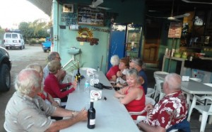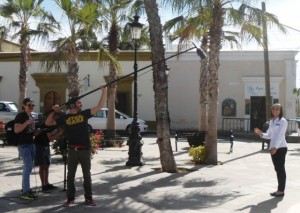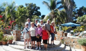
January 28, 2014 – Well we are in Mulege now at the Hotel Sereinidad and have yet to see Don Johnson the owner although I understand he is here. The group has settled in nicely yesterday was busy after leaving Puerto Escondido with stopping for a couple of photo ops then a long Military Checkpoint, always the case with the first one north. We fueled up just before our destination and Bruce & Marian pulled in at the same time that Chris & Jeannie drove by on the Hwy, just like old home week. After we got set up we headed out on an excursion, but first we dropped off the laundry to Ida. Then off to the lighthouse on the site of the historic Battle of Mulege, the only battle where the Mexican’s actually repelled the Americans in the conflict of 1846-1848, this is a great location to climb to the top and take photos of both the valley and the entrance to the Bay of Concepcion. Then we were off to the Loma Linda and a walking tour of this grand getaway for the rich and famous where Fred Astaire once danced, Ray Cannon wrote and Jayne Mansfield was married for the 3rd time. Then we headed for the Santa Rosalia Mission finished in 1766, ten (10) years before the United States of America was born. After we dropped by the Orchard (a former RV park), and looked at some of the wonderful homes that have survived the many hurricanes and tropical storms. We did bump into Chris & Jeannie again and had a brief chat and everyone saw the spot where they had bought. One last stop at the Iron Wood shop then back to the Serenidad for a Happy Hour and that closed off our day. Some may have wandered over to the Hotel for the Wifi and perhaps dinner, Lisa & I watched a movie.
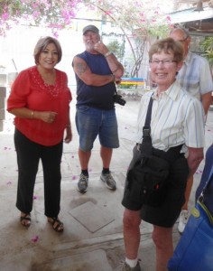
After leaving Cabo a few days ago we stopped of course at the Blanket Factory, Afrain was happy to see us as always. There was already another group shopping and he had the hot buns from the oven ready, very tasty for sure. We waited for Bobby across from the Pemex Station in Pescadero which is the routine however when he showed up he had bad news, the access road had been dug up and we could not get to the park! Luckly we had Plan B and headed off to the Cerritos RV Park behind the Cerritos Surf Colony. The only thing resembling an RV Park is the price, this is just a parking lot without any services. However we did get access to the WiFi, the pool, the bathrooms, the restaurant/bar and the beach. The bad news the folks who started the generators at 11pm, 3:30 am and again at 5 am. In addition we had a very unfriendly BCer (young guy) who did not like neighbours, particularly those with dogs. I actually mentioned to Lisa when we arrived that it seemed odd that a guy with a small truck pop-up camper would take 3 spots in the front row. Why is it that so many RVers that really want to camp alone put themselves in the middle of everyone else? Must be another mystery of life J. We missed the serenity of Bobby & Wendy’s campground and also realize that this Cerritos location is temporary at best, the owner is collecting some easy money before he builds his next hotel, he does not even provide garbage cans. Our 2nd day in Pescadero saw us head off for our tour of Todos Santos, everyone loved Casa Bentley which Robert & Beatrice graciously allowed me to take people around for a short tour. That night we headed over to see Jose and La Pasadita for dinner which we host for the group on each tour. This is a unique experience, a real only in Mexico eatery which the gang enjoyed.
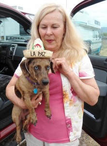
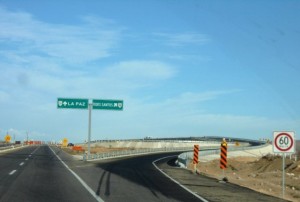
At 8:30 am the following day we departed for La Paz, Baja Sur’s capital city and seat of government, we used the newly completed bBypass around Todos santos, really slick. We had made arrangements to meet with Tom & Linda again for lunch so after a short stop at Walmart we headed off to the campground. After setting up Tom & Linda arrived, their negative breakdown experience well behind them. We tried out El Toro restaurant, very popular with locals. Really a seafood eatery they served large portions and it was good to get caught up with Tom & Linda who were headed off to Rancho Verde before settling into the East Cape RV Resort where they had made reservations for 2 months before picking back up with us in March in Cabo San Lucas to return home. We also saw Gerry & Ilona who we had not seen for almost 2 months as they had dropped off our previous tour in December. They had really enjoyed their time in La Paz and found many favourite spots and shops.
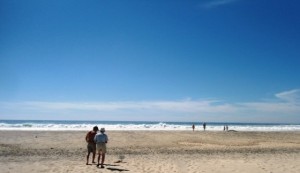
After lunch the group said goodbye to Tom & Linda and our next stop was Ibarra’s Pottery. Vicky was there and provided everyone with the history and background of their unique goods. Not surprisingly this was a popular stop. Then off we went to my favourite overlook of the La Paz Cemetery. After dropping off Lisa who does not like heights, we headed up and to my selected location. What a view! We then headed back to Campestra Maranatha Campground but first drove the entire Malecon, a real site to see on the waterfront in La Paz. The next day we dropped everyone off at the Madero Mercado with another short visit to Ibarra’s Pottery. We had a great lunch at our favourite Hot Dog/Hamburger Stand they met the gang on the Malecon, yes another great day. That evening some joined us for a dinner at Los Magueyes, we had not been there for a season and were glad we returned.
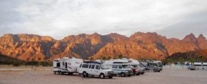
With Gerry & Ilona back in the caravan (the new #5), Puerto Escondido was our next destination and dinner at Porto Bello, Pedro’s place. Folks were very intrigued about this stop, particularly the marina and proposed development. Dinner was good for sure, it was great timing to get a ahead of the birthday group of 14 that came in after us. Sunrise was amazing as always, lots more great photos and memories. Today we are off to see Mulege and our walkabout, this evening dinner at Los Casitas.

Pacific coastal locations include Guerrero Negro, Magdalena Bay, San Carlos, and Todos Santos. Eastern side locations include Santa Rosalia, Mulege, Loreto, La Paz and East Cape. San Jose del Cabo and Cabo San Lucas reside at the tip of the peninsula and enjoy a little of both the Pacific and Sea of Cortez climates.
Winter
In winter weather patterns across the peninsula come from the north. Pacific storms can bring showers to a full blown downpour to any region of the peninsula, but the chances and the ferocity of the storms diminish as you move south. Although locals still see winter as winter, it is the favorite time of year for northern folks to come visit to escape the cold. The Sea of Cortez will dip into the low to mid 20c to 15c (low 70’s to mid 60’s F) and fishing is more limited. Winds are the strongest on average during the winter months. Temps are usually in the low to mid 20C/70’sF but a few days could be 10°+/- from that norm. North winds are the significant weather feature in the winter. Caused by High pressure moving over the 4 Corners Region of the U.S., north winds are the winter bane of much of the southern portion of the peninsula. Because the Sea of Cortez is almost perpetually cooler than the surrounding land mass, a trough, or canyon of air, runs south through the Sea.
When a High pressure system moves over the 4 Corners region of the U.S. the clockwise rotation of the system pumps cold air south, down the canyon of air, in an attempt to equalize the barometric pressure. The tropical air is warmer, the molecules further apart, is lighter and begins to rise. Because of the Coriolis Effect, the rising air spins counter-clockwise and a Low pressure system is born. In the winter months the mean air pressure in Baja is about 1012Mb. The cold arctic system over Colorado has dense air, which grows colder in the stratosphere and falls. The falling air spins clockwise and a High pressure system is formed. The strongest High to pass over the 4 Corners region in the winter of 2013 was about 1038Mb.
With the High pumping air into this invisible canyon in the sky, trying to equalize a barometric pressure difference of 25Mb or more strong winds is generated. When this event is about to materialize the barometric pressure along the Sea of Cortez will begin to rise. Winds will begin in the north-northwest and increase until they are coming from the north. As the High pressure moves east from the 4 Corners, the winds will begin to diminish and shift to the north-northeast and finally northeast.
Parades of these cold Highs can stack up from Washington and Oregon and out into the North Pacific. Periods of north winds to 45kts can bring large short period waves as large as three meters. The focal point of the raging winds, their ferocity and duration depend on the strength of the High and the position. A standard Norther will blow 25-30kts for 2-4 days, although they can be brief or endure for a week at a time. Norther’s begin in late November and can blow strong through mid March. As the northern hemisphere warms the Highs become less intense and move further north and the effect diminish. Northers most dramatically effect the Sea of Cortez side of the peninsula, but bring colder temps to most of the state.
Baja Sur sometimes receives winter rains, more prevalent in the north with the odds diminishing as you move south. But a couple times per season La Paz and Los Cabos will get a small Pacific storm that maintains enough strength to reach far south. This past season La Paz received almost 5.5 mm/1/4″ of rain from a storm moving northeast. This was caused by warmer tropical moisture moving northeast from the Hawaiian Islands running into a dry cold front, moving southeast from California. Many refer to the clouds and moisture that travel northeast as the “Pineapple Express”, but that name refers to another specific weather phoneme. This winter flow also brings a majority of the cloudy days to Baja Sur during the winter.
Southwest: Winter is the peak of whale watching season on the Pacific side of Baja California Sur. The Pacific cools off much faster than the Sea of Cortez and winter sets in by late December. Winter storms can work their way this far south in January and will be a persistent possibility through early March. Since the Pacific is the source of this region’s cooler climate, it is also damp. Storms have lost a lot of their punch by the time they get this far south, but the Pacific side is more likely to get rain that the Sea side in the winter. The Pacific will provide strong surf and places like Todos Santos attract many surfers in this season. Temperatures begin to warm up by late February and by early March spring and the mid 20C/70°F’s are in the air.
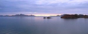
Southeast: Like the northern Sea of Cortez, the north winds bring the most significant weather, blowing cold air from the north down the Sea sometimes to 35kts or more. The most severe north winds blow in January into February and make places like La Ventana popular for wind surfing and kiting. Winter usually begins right after the New Year and there is the occasional Pacific winter storm that will bring a day or two of rain. It is not uncommon for there to be at least one good rain in the winter, of an inch or so accumulation. The Pacific tropical flow brings a bulk of the region’s cloudy days during winter and every once and a while a cold front from the north will squeeze a little drizzle from these clouds. Daytime highs are usually in the mid 20C/70’Fs and over night lows dip to 7-9C or the upper 40’Fs. Things begin to warm up by the end of February.
As all of us know, Cabo San Lucas is the southernmost point on the peninsula and straddles the Pacific and Sea of Cortez weather environments. The Pacific winds keep Cabo a little cooler year-round than other places in Baja Sur, but by the time you move just 20 miles to the east in San Jose del Cabo the climate is warmer and drier.
2014/2015 Winter Season
The northern state of Baja California receives a bulk of their rainfall during the December to February period and this year, with the seemingly unending Santa Ana conditions they have received only a smattering of rain so far this season. With just about two weeks of potential winter weather to go beyond the current forecast we may have one of the warmest winters on record here in Baja California Sur.
*Courtesy of Baja Insider

