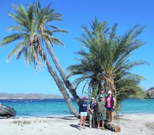
November 19, 2015 – We arrived in Loreto yesterday, still some wind but under sunny skies. Yolanda and her Mom are always so happy to see us, we really enjoy our time here. Dropped by to see Ubaldo and Marv & Shel, make preparations for next season and the Fiesta Night Dinner tonight. The tour has gone smoothly, only Alan had a brush on his driver’s side mirror although as always leading the group we witness other drivers conduct on the road that questions their sanity, both Mexican and mostly tourists. Why do they seem so keen to get to the next life?

Since my last Blog we have been to Fidel’s on the beach. Our journey included some new pavement and a little road construction, short term pain for long term gain. We had a great fire, wood courtesy of Fidel, hot dogs cooked well. We learned that Fidel’s daughter was killed last Easter by a drunk driver near the Gas Station on the Hwy, tragic. Fidel introduced us to his new girlfriend Cindy at the wiener roast, very pretty and younger than his daughter, she seemed very nice and is sure to keep Fidel busy for sure.
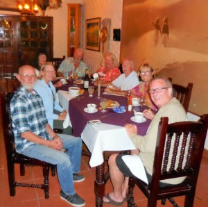
Next stop Catavina where the road had been patched, not repaired or repaved, still better than before. The arroyos at each end of town are both better than we have seen in some time, one day they will install bridges which are long overdue. Shortly after pulling into Santa Inez Ralph showed up, always eager to lend a hand if need be. Our excursion took us to the Cave Paintings than later dinner at the Cantina, dinner was good and inexpensive at 80 pesos each. 12 or 13 RVs made Santa Inez their stop that night, some came in late at night and left early, in a hurry to get south I guess?
The next morning we were off to Guerrero Negro and Malarrimos. Tony’s Tacos were as good as always, the internet was working well and dinner was superb, my Carne Asada was delicious. Lots of laughs at dinner, Alan had us in stiches. We met an Australian who had driven their 38’ Air Stream Motorhome from Gonzaga Bay to Mex 1, he did say the RV bounced around a lot, I bet! Unfortunately no Salt Tour so we were of at 11:00 AM, we did leave a bit late as Alan & Debbie’s RV step stopped functioning. Thanks to Ken we were on the road in no time, our fuel stop and body break at Vizciano include a lighting show and torrential rain we had never seen on Baja before, wow!

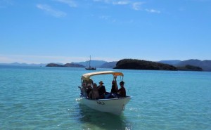
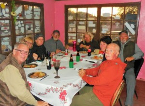
Ricardo greeted us at Rice & Beans and yes the Margaritas were still great. The tour into town included a stop at the Tortillaria for fresh tortillas. Off early in the morning for Playa Santispac and more new road just north of the Devil’s Grade, probably 5-6 km long, yes it all helps. They should take some of that equipment because the road into Santa Rosalia is awful, pot hole city. We arrived at Santispac intact, not many on the beach. Our friends Barb & Dennis from Ontario were there, as was George. Jack & Eric had taken the point where Bruce & Marian usually camp. The group took a boat trip and everyone had good use of the Kayak and SUP. The wind came up on Day 3 which was our Excursion Day to the beaches. We dropped in on Gwen & Gord at La Posada. They were on Los Cocos for many years decided to move to a more permeant spot, it was good to see them. Our Potluck dinner was good as always but we missed Bruce & Marian’s fire.
Did you know?
El Niño is an anomalous, yet periodic, warming of the central and eastern equatorial Pacific Ocean. For reasons still not well understood, every 2-7 years, this patch of ocean warms for six to 18 months. El Niño has an 80 percent chance of lasting into early spring 2016, according to an updated forecast released by the National Oceanic Atmospheric Administration (NOAA). NOAA also reported that there is a greater than 90 percent chance of El Niño lasting through the upcoming winter. The declaration that El Niño is likely to last into spring is important for the United States since precipitation and temperature impacts from a moderate-to-strong El Niño are typically most noticeable during the colder months.
Daily sea-surface temperature anomalies over the Pacific Ocean (degrees Celsius) on Sep. 8, 2015, relative to 1971-2000 average. The area highlighted by the black rectangle shows the warmer-than-average waters of the equatorial Pacific Ocean in the so-called Nino3 and Nino4 regions. Significant warm anomalies also were present in the eastern Pacific Ocean west of California and Mexico’s Baja peninsula, near Hawaii, and in the north Pacific, while cool anomalies were seen in parts of the western Pacific Ocean east of Japan. (NOAA/ESRL/PSD) NOAA reports that sea-surface temperature anomalies increased in June in the equatorial Pacific Ocean. In addition, NOAA says that many computer models are predicting that sea-surface temperature anomalies will continue to increase through the fall.
Typically, easterly trade winds near the equator pile warm water into the western Pacific Ocean. Conversely, the resultant upwelling, or upward movement of deep, cold ocean water keeps the eastern and central Pacific Ocean cooler. Thunderstorms require at least some degree of warm, humid air near the surface, so they’re more numerous and persistent over the western Pacific warm pool, and much less so in the eastern equatorial Pacific. During an El Niño, these trade winds weaken, and may at times reverse from west to east. Warmer western Pacific water then slowly sloshes back toward the central, even eastern Pacific Ocean in what’s known as an equatorial-trapped Kelvin wave. Therefore, the most persistent thunderstorms will shift from the western to the eastern and central Pacific Ocean in an El Niño. This trade wind reversal and the resulting reorientation of thunderstorms changes the atmospheric circulation not just over this swath of the equatorial Pacific Ocean, but can also have far-reaching impacts on the atmospheric circulation.
El Niño’s clearest impact on northern hemisphere weather patterns occurs from late fall through winter. Looking at past moderate-strong El Ninos, here are the upshots for temperatures and precipitation from late fall through winter in the U.S.:
– Wetter: Southern U.S. from California to the Carolinas then up parts of the East Coast
– Drier: Parts of the Ohio Valley, Great Lakes, Northwest and Northern Rockies
– Cooler: Desert Southwest, Southern Plains, northern Gulf Coast
– Warmer: Northern tier of states from the Pacific Northwest to the Northern Plains, Great Lakes, and Northeast
Note these are impacts that are typically expected, but they aren’t always the rule. Residents of the western states may remember the flooding that struck California during the strong 1997-98 El Nino. In February 1998, a series of storms caused an estimated $550 million in damage and killed 17 people in California. A total of 35 counties were declared federal disaster areas. This fits into the bucket of the wetter-than-average winter you would typically expect in a moderate or strong El Niño. Interestingly, during the previous winter there was also major flooding in California and it was even more costly with a total price tag of $1.8 billion, according to Jan Null, a consulting meteorologist in California. However, El Niño was not present that winter and rainfall for the season was near average. The flooding was the result of excessive rainfall that fell in a short time period combined with snowmelt from late December to early January.
The weak El Niño in the winter of 2006-07 provided a totally different story than what we saw in the very strong 1997-98 El Niño winter. California had its 23rd driest winter season on record when looking at the three-month period from December 2006 to February 2007. In Los Angeles, the entire water year from July 2006 to June 2007 was the driest on record with just 3.21 inches of rainfall. So, those hoping for drought relief next winter in the Golden State shouldn’t immediately draw a conclusion that significant rains are ahead in any El Niño year. The strength of the El Niño can play a role in the outcome. In addition, heavy rainfall can occur with or without El Niño present and that was the case in the winter preceding the strong 1997-1998 El Niño.
What About Hurricane Season?
There is a body of scientific evidence linking the occurrence of El Niño with increased wind shear in the tropical Atlantic Basin, which is one factor – along with dry air – that limits the development and strengthening of tropical cyclones. In fact, we’ve already seen record early June through early July wind shear in the Caribbean, according to Colorado State University tropical scientist Phil Klotzbach. Klotzbach also tweeted the late June-early July wind shear in the Caribbean was stronger than the average shear in January, there. During the 2013 hurricane season, 14 storms formed, but only two reached hurricane strength. Neither of these hurricanes reached major hurricane status, which is defined as Category 3 or stronger on the Saffir-Simpson Hurricane Wind Scale.
When considering overall season activity via the ACE index, 2013 was the least active Atlantic hurricane season since 1994. There was no El Niño in place in 2013. Now, consider the 2004 Atlantic hurricane season. Four hurricanes – Charley, Frances, Ivan and Jeanne – hammered Florida in less than six weeks. There were 15 storms and nine hurricanes that season, which is an active one by any measure, and it developed despite a weak El Niño. Taken together, the five El Niño hurricane seasons since 1995 averaged about 11 storms, 5 hurricanes, and 2-3 major hurricanes, a reduction of four storms, 3 hurricanes, and 1-2 major hurricanes from the average since 1995.
Prior to the current active phase of Atlantic hurricane activity (pre-1995), there were several other relatively slow hurricane seasons: 1982, 1986, 1987, 1991 and 1994. The 1982 season was particularly inactive, with only six tropical storms and two hurricanes. The next year, despite one of the strongest El Niños on record finally fading by early summer, only four storms formed the entire season.
Exactly where the equatorial Pacific Ocean warms in an El Niño matters, as well.
- Warming in the eastern equatorial Pacific: lower numbers of Atlantic tropical cyclones
- Warming in the central equatorial Pacific: higher numbers of Atlantic tropical cyclones
As we’ve stated, El Niño is only one driver of the atmospheric circulation. Wind shear over the Atlantic Basin may be less on some days, despite being higher when averaged over an entire season. While we have focused on numbers of storms and hurricanes, it’s ultimately a storm’s path that matters for impact. “Even if we get a strong El Niño, that doesn’t mean no U.S impacts (from hurricanes or tropical storms),” says Dr. Phil Klotzbach, a tropical meteorologist and researcher at Colorado State University. Klotzbach notes that Hurricane Betsy hit both Louisiana and Florida in 1965 and Agnes flooded out the eastern U.S. in 1972, both during strong El Niños. All it takes is one intense, landfalling hurricane to make many forget an El Niño was even there. Meanwhile, a hyperactive eastern and perhaps central Pacific hurricane season looks to be a virtual lock. Already, we had three simultaneous typhoons in the western Pacific Ocean in early July, and had the record earliest-in-season named storm in the central Pacific, Tropical Storm Ela. Colorado State University tropical scientist Phil Klotzbach found tropical cyclones are about three times more likely to impact Hawaii in El Niño years vs. La Nina years.
Ultimately, this El Niño will exert some influence on the numbers. However, all it takes is one tropical cyclone making landfall in a populated area to change perceptions of an active season.

