January 3, 2013 – After Christmas Lisa and I decided we needed to check out Hwy 5, San Felipe and beyond heading south. We have always heard plenty about this region however we have never actually been there. The road that currently connects to Mex 1 just south of Catavina is suitable only for a 4 wheel drive. We know that the road from Puertecitos towards Gonzaga Bay has been in construction for some time and is being built to the new Baja standard and when this highway is completed we may change out tour route. Really the only way for us to know is to be on the ground for ourselves and find out.
We crossed at Mexicali (mexi’kali) and took the suggested route by Mike & Terri Church entering on the east side of town from US Hwy 7. Mexicali is the capital of the Mexican state of Baja California, seat of the Municipality of Mexicali, and 2nd largest city in Baja California. The City of Mexicali has a population exceeding 700,000 and a regional population of 1 million. Founded on March 14, 1903, Mexicali has the distinction of being the northernmost city in Latin America. The Church’s directions were great and we were on Hwy 5 heading south in no time. Once on Hwy 5 we made great time heading south, the highway is a divided 4 lane road for some time the reduces to very good 2 lane then widens to 4 lanes again before entering San Felipe. We easily maintained 85km mindful that radar is used on this highway. Interesting enough there was a short section of road, perhaps 5 km, that remains narrow without shoulders.
We arrived in San Felipe about noon about 3.5 hours after we crossed the border. The Bay of San Felipe is 3 meters above sea level and at low tide, the water can recede as far out as 2km. This town experiences one of the largest tidal bores in the world due in part to the Colorado River delta to the north. The seven-meter tides can expose a kilometer of ocean floor. The population of San Felipe is about 18,000 increases by up to 5,000 due to the presence of Canadians and Americans during the holidays. The history of San Felipe began with the expeditions of Francisco de Ulloa, one of Cortés’s captains who navigated the bay in September 1535. In 1536, Hernando de Alarcón and Domingo Castillo explored the region and made the first detailed map of the peninsula, giving San Felipe its original name, Santa Catalina.
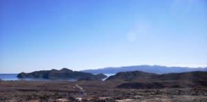
After a short stop in San Felipe we headed off to Puertecitos another 90 km south. Although paved, this road was in surprisingly rough condition with many treacherous vados, the problem being both sudden and short in length, without care these would raise havoc with most any kind of RV. It took us another two hours to get to Puertecitos, which was permanently settled in 1949 by Rafael Orozco. There are a couple of hundred homes and mobile homes in Puertecitos, mostly lying on a low hill which overlooks the Sea of Cortez on the east side, and the inner bay of Puertecitos on the west side. Puertecitos receives an average of two inches of rain a year with a similar climate to San Felipe. This village is known primarily for its hot springs and being a summer tourist destination. There are no hotel accommodations although there is a Pemex station. We camped at Octavios Campo, Playa Escondida a very nice beach.
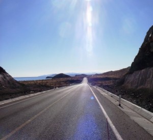
The next day we left the trailer behind and headed south towards Bahia de Gonzaga AKA Gonzaga Bay. From this point south the Hwy 5 is very scenic, actually quite stunning and the roadway is very good, once having had a reputation for being one of the worst roads in Baja. The new highway is paved within 5 or 6 km of Gonzaga Bay and still under construction. This should be complete by the start of the next Snowbird season. We stopped at Campo 5 Islas (located half way between Puertecitos and Gonzaga bay) for a coffee and spoke with Augstin Rubio at length, he is very optimistic that Hwy 5 will be completed within the next 2 years and this will include a new bypass of San Felipe and total rebuild of the hwy between San Felipe and Puertecitos.
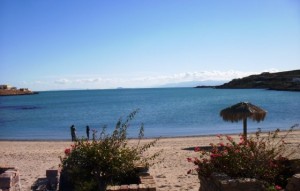
When all this happens we are likely to start our tours in Mexicali, stay tuned. FYI a very reasonable place to boondock is at Augstin’s Campo 5 Islas, which has good beach access and reasonable at 120 pesos per day. In years gone bye adventurers such as John Wayne would visit Gonzaga Bay to enjoy it’s stark beauty and solitude. Today’s visitors can enjoy these same pleasures. The Baja adventurer looking for raw beauty, peace and quiet, and a taste of the Sea of Cortez will find Gonzaga Bay hard to beat. The highway is posted at between 90 and 110 km per hour and a very easy drive with many very large scenic pullouts, something not seen much on Hwy 1. Hard to believe you could cross the border and be at the same point south as Catavina in 6 and half hours.
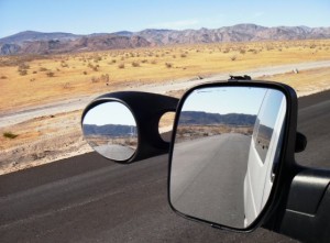
The next morning we decided to head north and head over to Algodones, another Baja destination we have heard much about but have never been. We left at 7am from Puertecitos and crossed back into the US at 11:30am, we made great time as there was not much traffic. When we arrived at the border we were very pleased to see hardly anyone there, just a few cars in front of us.
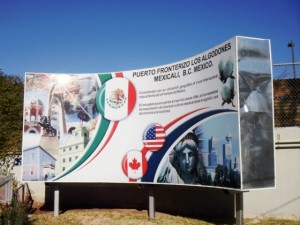
We drove I-8 and stayed at the Q Casino and the next morning headed to Los Algodones, a small Mexican town located on the extreme northeastern tip of the municipality of Mexicali, approximately 16 km (9.9 miles) west of Yuma, Arizona, USA. Interesting enough its official name is Vicente Guerrero, although most people use Algodones when referring to it. It reported a population of 5,474 as of the 2010 Mexican census and has the interesting geographical distinction that if someone were to travel in any of the four cardinal directions from anywhere in Algodones (due north, due east, due south, or due west), they would cross a U.S. border. Clearly the popularity of both inexpensive prescriptions and medical care catering to Canadian and US senior citizens have prompted a virtual explosion of pharmacies and dental offices which have largely displaced a great deal of the open-air shops and restaurants immediately across the border and have effectively shifted the town’s focus from tourism to medicine.
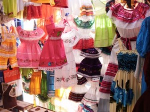
Nevertheless, a number of shops and restaurants remain and Los Algodones capitalizes on the tourist trade with frequent fiestas throughout the year, most notably around the Christmas season. We had a good wander around and tried out a couple of Taco stands, lots of gringos for sure; using pesos seemed like a foreign currency for most vendors. Did you know the name of the town, Algodones (The Cottons), Baja California, comes from the word cotton that has been cultivated in this region since old times and is believed to be derived from Halchidomas, the name of a Yuma Indian Tribe.
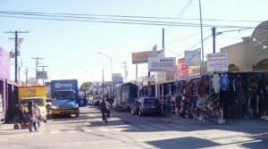
We are camped at the Oak Creek RV Resort and getting prepared to meet our January 2013 tour group on the 5th at Potrero, we really look forward meeting everyone and to heading south again and warmer temperatures and sunny skies.

