October 31, 2012 – After leaving San Francisco (Sylvia made it home safely) From Pacifica we continued on Highway 1, very scenic for sure and much calmer then the narrow switchback section we encountered north of San Francisco. We had heard from our Baja friends Frank & Carol about Colonel Allenworth State Historic Park not far from Bakersfield so we made that our destination, an easy drive.
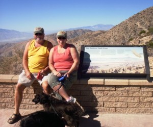
What an interesting place, this park preserves Allensworth, the only California town to be founded, financed and governed by African Americans. The small farming community was founded in 1908 by Lt. Colonel Allen Allensworth, Professor William Payne, William Peck, a minister; John W. Palmer, a miner; and Harry A. Mitchell, a real estate agent, dedicated to improving the economic and social status of African Americans. Colonel Allensworth (1842–1914) had a friendship with Booker T. Washington and was inspired by the Tuskegee Institute and development in its neighboring town. Allensworth hoped to develop the “Tuskegee of the West”. Uncontrollable circumstances, including a drop in the area’s water table, resulted in the town’s demise. Allensworth is now an unincorporated area in Tulare County.
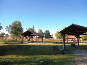
The preserved townsite features nine restored buildings, including a schoolhouse, a hotel, a general store and several homes. The park has a visitor center, and tours are available by making arrangements with the park in advance. The visitor center features a video presentation, “The Spirit of Allensworth.” The fifteen campsites do accommodate RVs and each site includes a picnic table and a camp stove; flush toilets are nearby. Facilities for disabled people are available. Turf, trees, and shade ramadas are other features. A nearby picnic area is shaded by 75 large trees, planted by the California Conservation Corps. Unfortunately they have been open only Friday thru Sunday since December 2010, great sites to get in and out of, dump station, showers and flush toilets, a great deal for $20 a night. We were the only campers in the park during our stay.
Next on our travel itinerary was the Joshua Tree National Park, we took a different route which included a stop at Camping World for a new BBQ and a night at WalMart in Palmdale. Our friends Bob & Melanie who participated in our 1st “Test” RV Caravan Tour on Baja in 2009 had told us much about this park and we were curious to check it out. It also meant we would avoid the hectic freeway traffic of San Bernadino and all the wind tunnels in the surrounding area, always a good thing. You pay $15 at the Entrance gate and $10 per night for dry camping with good clean pit toilets, we thought this was also very reasonable. Much of this park reminded us of Catavina on Baja.
The Mojave and Colorado Desert merge within the boundaries of this park. The higher and slightly cooler Mojave Desert is the special habitat of Yucca brevifolia, the Joshua tree for which the park is named. It occurs in patterns from dense forests to distantly spaced specimens. In addition to Joshua tree forests, the western part of the park includes some of the most interesting geologic displays found in California’s deserts. The dominant geologic features of this landscape are hills of bare rock, usually broken up into loose boulders. As you can imagine these hills are popular amongst rock climbing scrambling enthusiasts. The flatland between these hills is sparsely forested with Joshua trees. Together with the boulder piles and Skull Rock, the trees make the landscape very unique indeed. 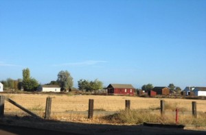
Below 3,000 feet (910 m), the Colorado Desert encompasses the eastern part of the park and features habitats of Creosote bush scrub Ocotillo, desert Saltbush and mixed scrub including Yucca and Cholla cactus (Cylindropuntia bigelovii). There are areas of such cactus density they appear as natural gardens. The lower Coachella Valley is on the southeastern side of the Park with sandy soil grasslands and desert dunes. The only palm native to California, the California Fan Palm (Washingtonia filifera), occurs naturally in five oases in the park, rare areas where water occurs naturally year round and all forms of wildlife abound.
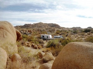
The rock formations of Joshua Tree National Park were formed 100 million years ago from the cooling of magma beneath the surface. Groundwater is responsible for the erosion that created the spheres from rectangular blocks. These prominent outcroppings are known as inselbergs or a monadnock (Bob Bentley in Todos Santos would know what these are). The Joshua Tree area has been the focus of sporadic archaeological investigations for over 60 years, but the sequence of prehistoric human occupations is still imperfectly understood. Fluted projectile points of the Paleo-Indian period (AKA Clovis) have been found in the region. These artifacts are thought to be associated with a tradition of big-game hunting that may date back to 9000 BC around the same time as the rock paintings across Baja. Artifacts of a slightly later period, the early Archaic, which include those of the Dieguito and Lake Mojave complexes, were also found in the region.
There is also evidence at Joshua Tree National Park of Paleo-Indian of Early Archaic occupations. There is good evidence of human occupation from the Middle and Late Archaic periods, which together range from 3000 BC to 1100 AD. After about 1000 AD, occupation of the area increased considerably, judging from the frequency of sites that date within the last thousand years. At the time of European contact, the boundaries of three American Indian groups—the Cahuilla, Chemehuevi, and Serrano—intersected at points now in the park. The descendants of these Indian groups continue to live in the area.
The first European to enter the area was a Spanish army officer, Pedro Fages, commander of California’s Spanish forces, who described the date palms, probably Joshua trees, that he saw as he crossed the Mojave Desert in 1772. There were more Spanish expeditions in the area in 1774 and 1776. The southern periphery of the present park was briefly explored from December 1823 through January 1824 by Captain Jose Romero, representing the government of Mexico, who was dispatched to find and evaluate for overland travel the east-west Cocopa-Maricopa Trail from San Bernardino to the Colorado River. The earliest American to explore this region was Jedediah Smith, who made an overland journey to California in 1826. He was a fur trapper with the Rocky Mountain Fur Company who visited the Mojave Indian villages along the Colorado River and trekked westward over the Mojave Indian trail toward the Pacific Ocean. There were few other early expeditions in the 1830s and 1840s.
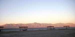
After a couple of days we exited the park heading south along a secondary route thru Box Canyon (another wonderful scenic drive) to the Salton Sea Recreation Area. We have always driven down the west side of the Salton Sea often stopping to see our Baja friends Petra and Gunther however they had not arrived yet so this time we headed to the east side, as suggested by another Baja friend Doris (AKA Dora the Explorer). Speaking with the Connie at the park this is a very popular destination with many Snowbirds, mostly Canadians. We thought the $20 fee was reasonable, flush toilets and showers, a great Information Center, full hookups available and lots of activities to participate in.
The Salton Sea was so named in 1905, but its history begins in the Salton Basin of ancient times – a time removed some 10,000 years ago. The present-day Salton Sea is a body of water that currently occupies the Salton Basin, but it is certainly not the first to do so. Historic evidence and geologic studies have shown that the Colorado River has spilled over into the Salton Basin on numerous occasions over the millennia, creating intermittent lakes. The first lake to arise was Lake Cahuilla in 700 A.D., which formed when the Colorado River silted up its normal egress to the Gulf of California and swung northward through two overflow channels.
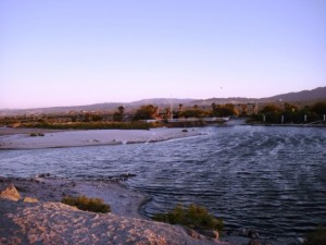
Evidence of an ancient shoreline suggests that Lake Cahuilla occupied the basin until about 300 years ago. From 1824 to 1904, Colorado River flows flooded the Salton Basin no fewer than eight times. For example, an 1840 flood created a salt lake three quarters of a mile long and a half a mile wide and, in June 1891, another outpouring of Colorado River water created a lake 30 miles long, 10 miles wide. It is uncertain as to how many times water has filled the Basin over the centuries but human intervention is responsible for inundating the basin only once.
In 1901, the California Development Company, seeking to realize the Imperial Valley’s potential for unlimited agricultural productivity, dug irrigation canals from the Colorado River. Heavy silt loads, however, inhibited the flow and new residents of the valley became worried. This prompted the engineers to create a cut in the western bank of the Colorado to allow more water to reach the valley. Unfortunately, heavy flood waters broke through the engineered canal and nearly all the river’s flow rushed into the valley. By the time the breach was closed, the present-day Salton Sea was formed.
Instead of evaporating over a period of years, today’s Salton Sea is maintained, in large part, by agricultural runoff from irrigation in the Imperial and Coachella valleys. Irrigation of these fertile valleys supports the Salton Sea and an industry that helps feed the world. Agricultural fields in the region join with the Salton Sea to support an ecosystem that attracts hundreds of species of birds and other wildlife. It is a crucial link in the Pacific Flyway, and a very important part of the Colorado River’s delta. The Salton Sea has many challenges including being much saltier then the Pacific Ocean however many environmental and community working with local authorities are working hard to sustain and improve the largest lake in Alta California.
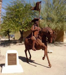
The Colorado River delta including the Salton Basin was first seen in 1540 by a Spanish explorer Melchior Diaz, who journeyed up the mouth of the river and sent expeditions to the present day Imperial Valley. Diaz was involved in three expeditions associated with the explorations of Francisco Vazquez de Coronado. The next serious expedition in the region was in 1604 by Don Juan de Ornate, Spanish Governor of New Mexico, who was a founder of various settlements in the present day American Southwest. Ornate is sometimes referred to as “the Last Conquistador.” Shortly after the last large infilling of Lake Cahuilla (Salton Sea) Don Juan Bautista de Anza leads the first large European party through what is now the Imperial Valley on the way to missions of San Gabriel in 1774. At this time the Spanish make first significant contact with the Cahuilla people, ancestors of present day Torres Martinez Desert Cahuilla Indians, there were about 6,000 members of the tribe. The first Americans to explore this region are trappers that include Kit Carson, Jedediah Smith and Wm. Wolfskill all making trips to the lower Colorado and the Salton Sink around 1825 to 1830.
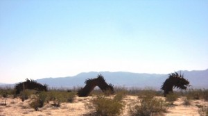
After leaving the Salton Sea Recreation Area we headed over to Borrego Springs, another very popular RV destination (we were here with Mussel Man Bruce and Margarita Marian last season) with a rich history (likely to be the subject of a future blog) and great weather then onto to the Viejas Casino (Terry, Lee and Dweezel from Modesto joined us here last season, rumour has it some Dweezel hair is still floating around the outlet stores) for a little dry camping and some trips into San Diego for tour supplies, tourist permits and everything else we will need for the Rendezvous Reception on Thursday, November 1st. We arrived at Potrero County Park yesterday as did some of our guests on tour. We have had a number of other RVs arrive as well, most from BC, some from Alberta, all heading for Baja including our friends from Tecolote, Bill and Marilyn. Great weather, great people and all heading for Baja California for the winter, what could be better eh?
Happy Halloween!

