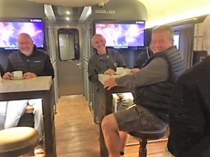
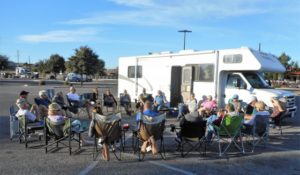
November 11, 2018 – We arrived at Roca Azul RV Resort on Laguna Chapala in Jalisco yesterday from Tequila, Jalisco and this morning sent the gang off to see Guadalajara. Lisa and I are watching the dogs which includes giving Lulu her insulin shots. We have been on tour for 11 days now and I finally have time to get this Blog out, this has been a busy past 11 days and more. At Baja Amigos we promise Fun & Adventure, two different words we remind people. The first 11 days have embraced this concept in spades.
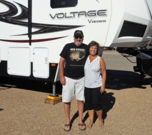
Orientation & Rendezvous – De Anza RV Resort, Amado, AZ – This was an opportunity to reacquaint our selves with everyone, most have been with us on Baja in the past, Mike & Linda were with Dom & Dianne, although we had met them. Unfortunately Gary & Bev could not meet us in Amado, they had to drive to Texas and register their RV they had purchased. We enjoyed our stay at the De Anza RV Resort, the owners very friendly and sites very clean and easy to get in and out.
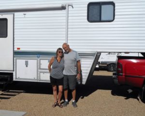
October 31-Nogales Home Depot, AZ – We all made our way to the Walmart parking lot in Nogales, AZ. This is when we first met Gary & Bev our Aussie guests from down under. The plan was to meet Paul’s group (Caravana de Mexico) and leave for the border crossing the next morning early. We had a Happy Hour with some last minute instructions, met the others and moved to the Home Depot up the hill for the night. Lots of last minute shopping at Walmart and a repair on Paul’s water heater which blew a connection just prior to the move. Good news Alf jumped in and before you knew it all was repaired.
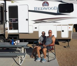
November 1 & 2-Totonaka RV Park, San Carlos, Sonora – 7am departure and we were off in a bit of a Texas scramble and gathered just on the street at the entrance to Home Depot. In an hour we were at KM 21 in Mexico doing our paperwork at 8:00 am, did not leave until 10:37 am. Those with pre-paid TIPs were in and out in no time at all, those without took longer. Alf & Barb took the longest, we believe the problem was the age of the truck, a 1999 Dodge. It appears the Mexicans were skeptical that Alf & Barb would actually use this for an RV and would sell it. Really not sure, but with Paul’s help and persistence, they issued a TIP.
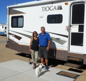
The drive was long, lots of road construction and at a fuel stop Bob & Debbie clipped a sandwich board sign (that was attached to the ground). Some damage (minor), but we chewed up time negotiating a resolve ($500 pesos). We arrived in San Carlos at sunset and the exit we would normally take off 15D was closed for construction which required a couple of U turns with an RV Caravan of 13 RVs. We did make it and set up in the dark, what a day.
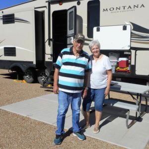
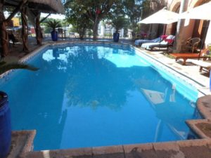
The original schedule called for a 1 night stop, worked out well that it was 2 because of the schedule change for the Copper Canyon Tour . Tried out the pool and pickle ball court. many went for a drive to Guaymas and into San Carlos. We can see lots of changes since we were here in 2002 with all our kids. The Wi-Fi (all important) was better then expected, the weather was perfect 28C for a high and 12C for a low. We hosted a dinner at the restaurant in front of the park and this was fun and very tasty, a good time by all.
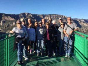
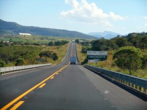
Day 3, 4, 5 & 6-El Fuerte, Sinaloa, Bugamvilla Motel & RV Parking – 8:00 am departure under sunny skies and we were off, we encountered more construction and our original plan to take Hwy 114 was changed as the hurricane damage made that route not possible. This added an additional 1.5 hours to our road time plus a couple of encounters with the Transito Police made for another long day but at least we got parked and set up before it go dark. Gabriel and his wife Fran met us at the park and at sunset our group met with them about their Copper Canyon Tour. After a few of us went across the street for dinner, this was a local Taqueria just like La Pasadita in Pescadero, Baja.
We cannot forget to mention the bity bugs at this place, they were brutal. They were on us before we knew and had dozens of bites and they were mega itchy. The gang got picked up at 7:25 am and they were off. Our time in El Fuerte with Mike & Kelly was fun, also very hot, 36C each day. We went town and checked out the Hotel of Zorro fame, the local Museo and the Zokolo. We also had dinner in town and did some shopping. The gang returned in the afternoon on Day 6 and some went into town, by all reports they had a wonderful time and Gabriel & Fran did a great job.
Day 7-Mazatlan, Sinaloa-We had a 7:30 am departure and it took hours doing the posted speed limit to reach Hwy 15D, Mexicans were not happy and blasted by us, some were visibly pissed. However we could not risk more stops by the Transito Police. It is a problem to have one set of rules for locals and another set for tourists. No problems with the drive and we arrived at about 3:30 pm. The sites we tight but they worked. Laundry & Wi-Fi at the office, next season this will be a 2 night stop as originally planned.
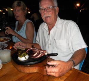
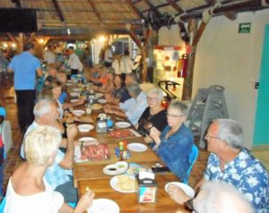
Day 8 -Tequila, Jalisco – This was a stunning drive, very beautiful and lush green everywhere. Our stay at the baseball field was interesting, both with challenges in and out along a narrow neighbourhood road. Lots of extra work was required when we arrived and left. Our local organizer Brayan was helpful and worked a lot on my Spanish. We walked to the square (8 minutes), so the location was excellent. The field was flat, so all good there. We went for an optional group dinner at a traditional restaurant, lots of fun and good food.
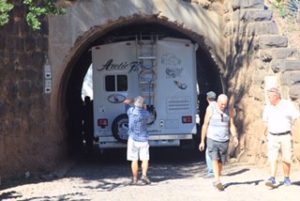
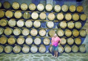
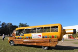
Day 9 – Casa Herradura – This was a day to remember for all time. The entrance to Casa Herradura included Railway tunnel which most could not fit thru, as it turns out, also not us. We attempted this and got stuck, luckily only a couple of scratches on the housing for the awning. It was a Mexican moment for sure extracting the trailer from the tunnel then getting it turned around. The distillery had no record of reservations for us and the person we dealt with had left months earlier. The photos I sent (pictures of an RV Caravan) were a waste of time. Clearly the person we were dealing with had no idea or concern regarding what we needed. We ended up sleeping on the street, which was noisy and uncomfortable as most could barely put the slides out. The tour was long, but good, Saul did a good job. Could we accessed the Casa Herradura property there were plenty of great parking spots for our RVs. It was a noisy night. On a bright spot I confirmed with Sylvia (nee Parker) that Bruce Parker was my biological father and have six siblings. Looks like a road trip next summer.
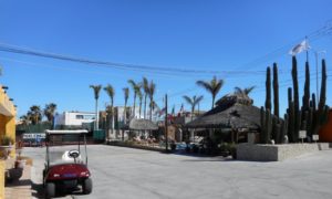
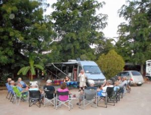
Day 10 – Roca Azul, Laguna Chapala – We had the poorest start ever and it was my fault. I had told everyone we were leaving at about 8:30 am and there was no hurry. We were up early and moved our trailer off the street where we were a choke point for traffic. Chris & Dixie and Mike & Susan were ready to go. My idea was that we should get out of the way and find a spot for all of us to regroup. Good concept, poorly executed. What I should have done is communicate this change to everyone, not just a couple of people. Some folks were asleep when we left and that was bad. Luckily Mike and Kelly, our Tail Gunners, stepped in and took charge. It all worked out but I created way to much stress by not clearly communicating to everyone. We gathered down the road at a new Pemex station that was still under construction. The drive to Roca Azul was uneventful except at the end and took the wrong entrance. Some were able to carry on 100 meters down the road to the correct entrance, the rest had to back out, yet another cluster. We ended the day with a hosted Margarita Happy Hour, Fun & Adventure, two different words.
*Thanks to Alf & Mike H for moving my hitch to a higher position, this should help our front stairs from dragging over uneven payment.
Did you know?
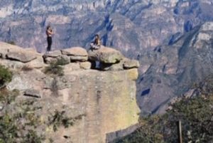
Copper Canyon (Spanish: Barrancas del Cobre) is a group of canyons consisting of six distinct canyons in the Sierra Madre Occidental in the southwestern part of the state of Chihuahua in northwestern Mexico. The overall canyon system is the result of more than 60 million years of erosion and is 4X larger than the Grand Canyon in Arizona. The canyons were formed by six rivers that drain the western side of the Sierra Tarahumara (a part of the Sierra Madre Occidental). All six rivers merge into the Rio Fuerte and empty into the Gulf of California. The walls of the canyon are a copper/green color, which is where the name originates. The city of Los Mochis is a gateway town to Mexico’s famous Copper Canyon which is one of Mexico’s most spectacular mountain adventures!
History
The Spanish arrived in the Copper Canyon area in the 17th century and encountered the indigenous locals throughout Chihuahua. New Spain (Mexico) was a new land to explore for gold and silver and spread Christianity. The Spanish named the people they encountered “Tarahumara”, derived from the word Raramuri, which is what the indigenous people call themselves. Some scholars theorize that this word may mean ‘The running people’. During the 17th century, silver was discovered by the Spaniards in the land of the Tarahumara tribe. Some were enslaved for mining efforts which led to uprisings by the Indians. They eventually were forced off the more desirable lands and up into the canyon cliffs.
Cities and towns- Among the villages located in or on the Copper Canyon are:
• Bahuichivo, ChePe train stop for Cerocahui, Urique, Piedras Verdes, Tubares
• Basaseachi, located near the pouroff of 840 ft (246m) Cascada Basaseachi in the Barranca Candameña. The towns and ranchos of San Lorenzo, Cahuisori, and Huahumar encircle the rim of the canyon, also home to Mexico’s highest waterfall Piedra Volada (1200 m). Located on Federal Highway 16 between Chihuahua, Chihuahua, and Hermosillo, Sonora. The Rio Candameña is a tributary of the Rio Mayo which flows into the Gulf of California.
• Batopilas, elevation 600 m, a town on the Batopilas River at the bottom of a canyon; first established by the Spanish around 1632 to mine silver. It is located 30 km southeast of Urique.
• Bocoyna, 30 km east of Creel, and on the eastern escarpment of the continental divide. The nearby Rio Conchos flows into the Rio Bravo (Rio Grande) on the Mexico-Texas border. Carichí, Sisoguichi, and Panalachi are important Tarahumara settlements on the Rio Conchos drainage system.
• Cerocahui, 14 km S. of the train stop at Bahuichivo.
• Creel, atop the canyon and, at 2,340 metres (7,677 ft) altitude, marking one of the highest points on the ChePe railroad route (San Juanito is higher at 2,400 metres (7,874 ft)); a central point for commerce and tourism.
• Divisadero, a key train stop and vista point with amazing views down into the Urique Canyon of the Barranca del Cobre. The ChePe train allows a 15-20 minute stop for visitors to enjoy the view. Divisadero and nearby Areponapuchi (located 4 km south) are major canyon-rim trailheads for hiking into the Rio Urique canyon.
• Témoris, a dual town located 400 m apart in elevation. The ChePe train traverses the valley 3 times including a mile long tunnel to gain elevation. Located on the Rio Septentrion, lower Temoris is at 1000 m.
• Urique, 560 m. Located at the bottom of the canyon rim below Bahuichivo, on the Urique River. It is 30 km NW of Batopilas, now connected by a rough road.
Ferrocarril Chihuahua al Pacífico
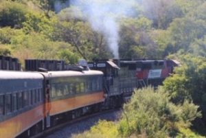
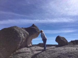
The Ferrocarril Chihuahua al Pacífico (Chihuahua-Pacific Railway), also known as El Chepe from its reporting mark CHP, or Ferrocarril Chihuahua-Pacífico is a major rail line in northwest Mexico, linking the city of Chihuahua, Chihuahua, to the city of Los Mochis, Sinaloa and its port Topolobampo. It runs 673 km (418 mi), traversing the Copper Canyon, a beautiful and rugged series of canyons that have led some to call this the most scenic railroad trip on the continent. It is both an important transportation system for locals and a draw for tourists. The tracks pass over 37 bridges and through 86 tunnels, rising as high as 2,400 m (7,900 ft) above sea level near Divisadero (the continental divide), a popular lookout spot over the canyons. Each one-way trip takes roughly 15 hours and is the preferred way to enjoy this scenic wonderland. The track also crosses over itself to gain elevation. Actual canyon elevations run as high as 9,500 feet above sea level, while the surrounding mountains rise to over 12,000 feet! Along the railway, many Tarahumarans lay out their food, crafts and other wares for sale.
History
The concept of the railroad was officially recognized in 1880, when the president of Mexico, General Manuel González, granted a rail concession to Albert Kinsey Owen of the Utopia Socialist Colony of New Harmony, Indiana, USA, who was seeking to develop a socialist colony. The railroad was actually built by Arthur Stilwell as the Kansas City, Mexico and Orient Railway, starting about 1900. The Mexican revolution, lack of funding, and the overall difficulty of building a railroad over such terrain hindered its completion until 1961. The private rail franchise Ferromex took over the railroad from the Mexican government in 1998.
Schedule
Two passenger trains (68 passengers) run daily: a slower service with more stops for locals—15 official stops including 50+ flag stops where boarding’s or disembarkations can be made at passenger request—and the other a direct service for tourists that is faster and more expensive. There is also regular cargo service running between Topolobampo and Chihuahua which might be further increased and extended so as to connect with the Texas Pacifico Transportation Railroad at the Ojinaga Presidio Crossing into the United States as a part of the La Entrada al Pacifico. The practice of loading RVs on railroad flatcars (with owners inside) in Ciudad Chihuahua, then delivered to Los Mochis ended about 10 years ago.
Tarahumara or Rarámuri
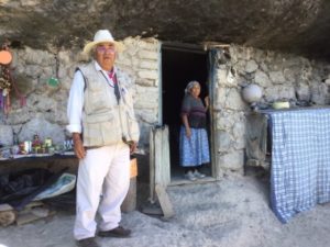
Copper Canyon traditional inhabitants are the Tarahumara or Rarámuri. The Rarámuri or Tarahumara are a Native American people of northwestern Mexico who are renowned for their long-distance running ability. Living in the canyons, they travel great vertical distances, which they often do by running nonstop for hours. A popular Rarámuri community race called rarajipari, is played by kicking a wooden ball along the paths of the steep canyons. n their language, the term rarámuri refers specifically to the men, women are referred to as mukí (individually) and as omugí or igómale (collectively). Originally inhabitants of much of the state of Chihuahua, the Rarámuri retreated to the high sierras and canyons such as the Copper Canyon in the Sierra Madre Occidental on the arrival of Spanish explorers in the 16th century. The area of the Sierra Madre Occidental which they now inhabit is often called the Sierra Tarahumara because of their presence.
Current estimates put the population of the Rarámuri in 2006 at between 50,000 and 70,000 people. Most still practice a traditional lifestyle, inhabiting natural shelters such as caves or cliff overhangs, as well as small cabins of wood or stone. Staple crops are corn and beans; however, many of the Rarámuri still practice transhumance, raising cattle, sheep, and goats. Almost all Rarámuri migrate in some form or another in the course of the year. Many Rarámuri reside in the cooler, mountainous regions during the hot summer months and migrate deeper into the canyons in the cooler winter months, where the climate is more temperate. Their survival strategies have been to occupy areas that are too remote for city people, way off-the-beaten-path, to remain isolated and independent, so as to avoid losing their culture. Many Rarámuri groups maintain their independence by living in areas that are as far away from city life as possible. Their way of life is protected by the mountainous landscape. The Tarahumara language belongs to the Uto-Aztecan family. Although it is in decline under pressure from Spanish, it is still widely spoken.
History
The Tarahumara are believed to be descended from the Mogollon culture. The Raramuri were introduced to the Spanish in the 1500s, and the Spanish called them the Tarahumara. By the early 17th century, the Spanish had established mines in Tarahumara territory and made some slave raids to obtain mine slaves. Jesuit Juan Fonte established a mission, San Pablo Balleza, at the southern end of Tarahumara territory, expanding from missionary work with the Tepehuan to the south. The Tepehuan’s violent resistance to Spanish incursion in 1616 killed Fonte and closed the mission for over a decade. The discovery of the mines of Parral, Chihuahua, in 1631 increased Spanish presence in Tarahumara lands, bringing more slave raids and Jesuit missionaries. Missions were established at Las Bocas, Huejotitlan, San Felipe and Satevo. In 1648, the Tarahumara waged war against the Spanish. They met at Fariagic and then destroyed the mission of San Francisco de Borja. Two of the leaders of this attack were captured by the Spanish and executed. Shortly after, the Spanish established Villa de Aguilar in the heart of the upper Tarahumara county.
After this the Tarahumara split into two groups. Those in the lower missions continued to move into the general Christian population and largely lost their tribal identity. Those in the upper areas went to war under the leadership of Tepórame and others. This drove the Jesuits and Spanish settlers from the area. The Jesuits returned in the 1670s and baptized thousands of Tarahumara, but these people retained a separate identity. Tepórame was executed by the Spanish in 1690. From 1696 to 1698, the Tarahumara again waged war against the Spanish, but were defeated. By 1753, the lower Tarahumara missions were turned over to secular priests, and in 1767 the Jesuits were expelled in Spanish territories. Most missions in Tarahumara ceased to operate or were turned over to Franciscans. Despite devoted and enthusiastic efforts, the Franciscans could not match the Jesuits’ feats, and the missions declined. The Jesuits re-established the missions in the early 20th century.
Athletic prowess
The Tarahumara word for themselves, Rarámuri, means “runners on foot” or “those who run fast” in their native tongue. With widely dispersed settlements, these people developed a tradition of long-distance running up to 200 miles (320 km) in one session, over a period of two days through their homeland of rough canyon country, for inter-village communication and transportation and hunting. Their running in sandals are described in the book Born to Run.
Threats & Challenges to the Tarahumara
The Tarahumara were not conquered by the Aztecs, and survived wars with the Spanish, the French and the Americans but today they struggle to protect their land from being taken by the Mexican army, drug lords or corporations that want to exploit their mineral resources.
“Lest we forget” today is Remembrance Day in Canada, a day to remember all the brave men and women that have fallen serving our nation.
