October 22, 2015 – Well we had no problem getting away on schedule heading out after the Thanksgiving weekend, the weather was great, sunny skies and no wind. We arrived in Woodburn, Oregon right on schedule, about 4:15 pm at our usual spot WalMart, lots of other RVs were already there, many arriving later. Day 2 on the road and we were off south bound once again on the I-5, next stop Weed, CA and the Friendly RV Park. We were shocked at the lack of Snow Pack on Mount Shasta, very different then just 2 years before at the same time of year. Even when we passed by in April heading north the Snow Pack seemed extensive.
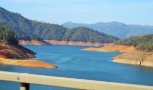
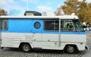
The next day soon after departure we were stunned at the empty reservoirs further along the interstate, yes climate change is real. This would also be the day that our vehicle problems started to arise. On starting our Van after the first body break at a Rest Stop Lisa says “What is that noise”, my response “Must be one of the big trucks around us”. Wrong answer. At the next stop it became apparent that the whirring sound was generated from our Van, sounded like from the transmission. I checked the tranny dip stick, nothing showing, this was bad. I called the Hallmark Ford Service Department, they had just serviced the vehicle (60K Service) which also included a full tranny service. We had a litre of Ford tranny fluid which they directed me to put in, this brought the level up to full; unfortunately the whirring continued. They instructed us to get to a Ford dealership to see what was happening.
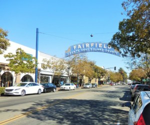
We had planned to go to Vacaville anyway, just a short distance away. Got set up in the Midway RV Park and contacted a local Ford dealership not far away in Fairfield, home of the Jelly Belly Factory. Unfortunately they could not even look at the Van until October 22 (a week away). I was able to drive to a triple AAA certified shop in Vacaville and they determined the following day, yes the transmission on our 2013 Ford E350 (62,000 km) was hooped, major internal mechanical failure. Luckily a Ford dealership in nearby Dixon was able to squeeze us in and start work in earnest on the Van on Monday, October 19th. Good news all under warranty (100K/5 years).
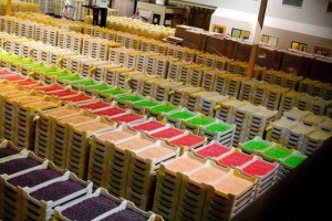
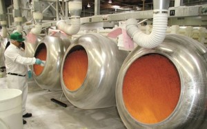
Making lemonade out of lemons we decide to carry on with our plans to visit the Jelly Belly factory and expand our touring to include Sacramento, the Capital City of California. The Jelly Belly factory was very impressive and had a great tour. Jelly Belly Candy Company, formerly known as Herman Goelitz Candy Company and Goelitz Confectionery Company, manufactures Jelly Belly jelly eans and other candy. The company is based in Fairfield, California, with a second manufacturing facility in North Chicago, Illinois and a distribution center in Pleasant Prairie, Wisconsin. In October 2008 the company opened a 50,000 sq ft (4,645 m2) manufacturing plant in Rayong, Thailand where it produces confectionery for the international market.
What was really interesting was the relationship between Ronald Reagan and Jelly Bellys. When Ronald Reagan ran for Governor of California in 1966, he began eating “Goelitz Mini Jelly Beans” as part of his successful attempt to give up pipe smoking. Herman Goelitz Candy Company, the Oakland-based producer of the jelly beans, sent a monthly shipment to the Governor’s Office throughout Reagan’s two terms in Sacramento. The company also made a custom-designed jelly bean jar for Reagan. After Reagan left the governorship, he continued to receive shipments of Goelitz Mini Gourmet Jelly Beans directly from the company. When Herman Goelitz introduced its Jelly Belly brand of jelly beans in 1976, it began including the new brand in Reagan’s regular shipment. Within two years, the shipment consisted entirely of the Jelly Belly brand.
Three and a half tons of red, white, and blue Jelly Belly jelly beans were shipped to Washington, DC for the 1981 Inaugural festivities. Blueberry, one of Jelly Belly brand’s most popular flavors, was developed in 1980. Its blue color completed the other flag colored Jelly Belly jelly beans, the red (Very Cherry) and white (Coconut). Herman Goelitz Candy Company provided the Reagan White House with Jelly Belly jelly beans for all eight years of Reagan’s presidency. In February 1981 Herman G. Rowland, the president of Herman Goelitz and a fourth-generation descendant of the company’s founders, received official Government authorization to develop a Jelly Belly jelly bean jar with the Presidential Seal on it. These Presidential jars of Jelly Belly beans, each in its own blue gift box, were given by Reagan to heads of state, diplomats, and many other White House guests.
President Reagan’s favorite Jelly Belly flavor was licorice.
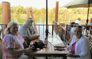
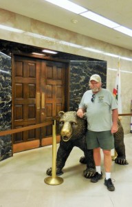
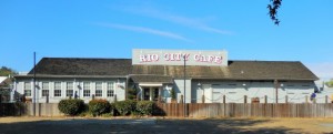
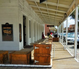
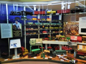
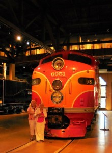
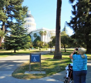
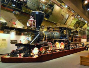
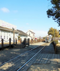
Our unscheduled stay also included a couple of visits to Sacramento, we started with Old Town Sacramento, great Railway Museum, Capital Building, Governor’s Mansion (who is moving back in) and more, we really enjoyed Sacramento, very clean and we thought livable. We also ate at a number of terrific eateries and restaurant’s that included Bud’s Pub & Grill (Dixon), an Italian Restaurant/Café in Fairfield, The Olive Garden (Vacaville), Rio Café (Old Town Sacramento) and the Bankok Restaurant in Sacramento.
The good news is the Van is repaired and will be delivered today. We should be on our way this afternoon, we are heading to Terry & Lee Pratt’s in Modesto, just a couple of hours away. All in all, an unexpected but enjoyable stop.
Did you know?
Sacramento (Spanish: [sakɾaˈmento]) is the capital city of the U.S. state of California and the seat of government of Sacramento County. It is at the confluence of the Sacramento River and the American River in the northern portion of California’s expansive Central Valley. Its estimated 2014 population of 485,199 made it the sixth-largest city in California. Sacramento is the cultural and economic core of the Sacramento metropolitan area, which includes seven counties with a 2010 population of 2,414,783. Its metropolitan area is the fourth largest in California after the Greater Los Angeles area, the San Francisco Bay Area, and the San Diego metropolitan area, and is the 27th largest in the United States. In 2002, the Civil Rights Project at Harvard University conducted for TIME magazine named Sacramento “America’s Most Diverse City”.
 Sacramento became a city through the efforts of the Swiss immigrant John Sutter, Sr., his son John Sutter, Jr., and James W. Marshall. Sacramento grew quickly thanks to the protection of Sutter’s Fort, which was established by Sutter in 1839. During the California Gold Rush, Sacramento was a major distribution point, a commercial and agricultural center, and a terminus for wagon trains, stagecoaches, riverboats, the telegraph, the Pony Express, and the First Transcontinental Railroad. The city was named after the Sacramento River, which forms its western border. The river was named by Spanish cavalry officer Gabriel Moraga for the Santísimo Sacramento (Blessed Sacrament), referring to the Catholic Eucharist.
Indigenous culture
Nisenan (Southern Maidu) and Plains Miwok Native Americans had lived in the area for perhaps thousands of years. Unlike the settlers who would eventually make Sacramento their home, these Native Americans left little evidence of their existence. Traditionally, their diet was dominated by acorns taken from the plentiful oak trees in the region, and by fruits, bulbs, seeds, and roots gathered throughout the year.
Spanish exploration
In 1808, the Spanish explorer Gabriel Moraga discovered and named the Sacramento Valley and the Sacramento River. A Spanish writer with the Moraga expedition wrote: “Canopies of oaks and cottonwoods, many festooned with grapevines, overhung both sides of the blue current. Birds chattered in the trees and big fish darted through the pellucid depths. The air was like champagne, and (the Spaniards) drank deep of it, drank in the beauty around them. “Es como el sagrado sacramento! (It’s like the Blessed Sacrament.)” As mentioned before the valley and the river were then christened after the “Most Holy Sacrament of the Body and Blood of Christ,” referring to the Catholic sacrament of the Eucharist.
Gabriel Moraga
(1765 – June 14, 1823) was a Spanish army officer in the Viceroyalty of New Spain, an Alta California explorer, and son of the pioneer José Joaquín Moraga. Although born in Fronteras, Sonora, Mexico, Moraga spent most of his life in Alta California passing away in Santa Barbara. Moraga’s explorations were extensive and very significant.
De Anza expeditions
The elder Moraga was a member of both expeditions of Juan Bautista de Anza to explore and consolidate the north-western limits of Spain’s colonial claims in Alta California. The first expedition in 1774 established a new overland route from Sonora, Mexico to Mission San Gabriel. The second, in 1775-6, went as far north as San Francisco Bay. The second expedition included a group of colonists for settlement at the newly established San Francisco Presidio, Mission San Francisco de Asís and Mission Santa Clara de Asís. The colonists included the Moraga family. José Moraga became commander of the garrison at San Francisco Presidio, and Gabriel became a soldier as well.
Early career
As a corporal, Gabriel Moraga was appointed comisionado (military administrator) of the Pueblo of San Jose, some years after its establishment by his father in 1777. When another civilian town, the Villa de Branciforte, was established in 1797 (part of today’s city of Santa Cruz), Corporal Moraga was transferred to the same position there and was replaced at San Jose by Corporal Ignacio Vallejo, father of Mariano Vallejo.
Central Valley
Gabriel Moraga was one of the first Europeans to see the Central Valley of California. He led the first official Spanish expeditions to explore the valley in 1806–1808. Many of the names which Moraga gave to places in the region (especially rivers) have survived, often in shortened and/or anglicized form:
- Sacramento River, after Moraga’s Rio del Santissimo Sacramento (“River of the Most Blessed Sacrament”), later applied to the capital of California, Sacramento and Sacramento County
- San Joaquin River, later applied to the San Joaquin Valley and San Joaquin County
- Merced River, which Moraga named El Río de Nuestra Señora de la Merced (The River of Our Lady of Mercy), later applied to the city of Merced and Merced County
- Kings River, which he named Río de los Santos Reyes (River of the Holy Kings), later applied to Kings County
- Calaveras River or Río de las Calaveras (named after Native American skulls found there), later applied to Calaveras County
- Mariposa River and the old name of the Chowchilla River, Big Mariposa River, later applied to the town of Mariposa and Mariposa County which was named after the swarms of butterflies Moraga found in the region of Chowchilla.
Not all of Moraga’s place names have survived. Today’s Stanislaus River was named Rio de Nuestra Señora de Guadalupe by Moraga. Even at the early date of Moraga’s expedition, the name was redundant. Today’s Guadalupe River was named in 1776 by the de Anza expedition.
Mexican Period: Sutter’s Fort and New Helvetia
John Sutter first arrived on August 13, 1839 at the divergence of the American and Sacramento Rivers with a Mexican land grant of 50,000 acres. The next year, he and his party established Sutter’s Fort, a massive adobe structure with walls eighteen feet high and three feet thick. Representing Mexico, Sutter called his colony New Helvetia, a Swiss inspired name, and was the political authority and dispenser of justice in the new settlement. Soon, the colony began to grow as more and more pioneers headed west. Within just a few short years, John Sutter had become a grand success, owning a ten-acre orchard and a herd of thirteen thousand cattle. Fort Sutter became a regular stop for the increasing number of immigrants coming through the valley. In 1847, Sutter hired James Marshall to build a sawmill so that he could continue to expand his empire.
From pioneers to gold fever
SutteIn 1847 Sutter received 2,000 fruit trees, which started the agriculture industry in the Sacramento Valley. In 1848, when gold was discovered by James W. Marshall at Sutter’s Mill in Coloma (located some 50 miles (80.5 km), northeast of the fort), a large number of gold-seekers came to the area, increasing the population. John Sutter, Jr. then planned the City of Sacramento 2 miles south of New Helvetia, in association with Sam Brannan against the wishes of his father, naming the city after the Sacramento River for commercial reasons. He hired topographical engineer William H. Warner to draft the official layout of the city, which included 26 lettered and 31 numbered streets (today’s grid from C St. to Broadway and from Front St. to Alhambra Blvd.). However, a bitterness grew between the elder Sutter and his son as Sacramento became an overnight commercial success (Sutter’s Fort, Mill and the town of Sutterville, all founded by John Sutter, Sr., would eventually fail).
The citizens of Sacramento adopted a city charter in 1849, which was recognized by the state legislature in 1850. Sacramento is the oldest incorporated city in California, incorporated on February 27, 1850. During the early 1850s the Sacramento valley was devastated by floods, fires and cholera epidemics. Despite this, because of its position just downstream from the Mother Lode in the Sierra Nevada, the new city grew, quickly reaching a population of 10,000.
Remnants of downtown Sacramento’s Chinatown
Throughout the early 1840s and 1850s, China was at war with Great Britain and France in the First and Second Opium Wars. The wars, along with endemic poverty in China, helped drive many Chinese immigrants to America. Many first came to San Francisco, which was then the largest city in California, which was known as “Dai Fow” (The Big City) and some came eventually to Sacramento (then the second-largest city in California), which is known as “Yee Fow” (Second City). Many of these immigrants came in hopes for a better life as well as the possibility of finding gold in the foothills east of Sacramento.
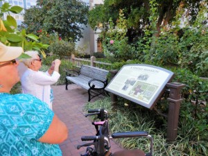
Sacramento’s Chinatown was located on “I” Street from Second to Sixth Streets. At the time this area of “I” Street was considered a health hazard as, lying within a levee zone it was lower than other parts of the city which were situated on higher land. Throughout Sacramento’s Chinatown history there were fires, acts of discrimination, and prejudicial legislation such as the Chinese Exclusion Act that was not repealed until 1943. The mysterious fires were thought to be set off by those who did not take a liking to the Chinese working class. Ordinances on what was viable building material were set into place to try to get the Chinese to move out. Newspapers such as The Sacramento Union, at the time, wrote stories that portrayed the Chinese in an unfavorable light to inspire ethnic discrimination and drive the Chinese away. As the years passed, a railroad was created over parts of the Chinatown and further politics and laws would make it even harder for Chinese workers to sustain a living in Sacramento. While the east side of the country fought for higher wages and fewer working hours, many cities in the western United States wanted the Chinese out because of the belief that they were stealing jobs from the white working class.
The Chinese remained resilient despite these efforts. They built their buildings out of bricks just as the building guidelines established. They helped build part of the railroads that span the city as well as making a great contribution to the transcontinental railroad that spans the United States. They also helped build the levees within Sacramento and the surrounding cities. As a result, they are a well-recognized part of Sacramento’s history and heritage.
While most of Sacramento’s Chinatown has now been razed, a small Chinatown mall remains, as well as a museum dedicated to the history of Sacramento’s Chinatown and the contributions Chinese Americans have made to the city. Amtrak sits along what was part of Sacramento’s Chinatown “I” Street.
Capital city
The California State Legislature, with the support of Governor John Bigler, moved to Sacramento in 1854. The capital of California under Spanish (and, subsequently, Mexican) rule had been Monterey, where in 1849 the first Constitutional Convention and state elections were held. The convention decided that San Jose would be the new state’s capital. After 1850, when California’s statehood was ratified, the legislature met in San Jose until 1851, Vallejo in 1852, and Benicia in 1853, before moving to Sacramento. In the 1879 Constitutional Convention, Sacramento was named to be the permanent state capital.
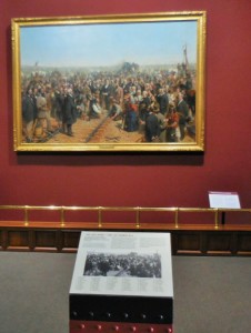
Begun in 1860 to be reminiscent of the United States Capitol in Washington, DC, the Classical Revival style California State Capitol was completed in 1874. In 1861, the legislative session was moved to the Merchants Exchange Building in San Francisco for one session because of massive flooding in Sacramento. The legislative chambers were first occupied in 1869 while construction continued. From 1862 to 1868, part of the Leland Stanford Mansion was used for the governor’s offices during Stanford’s tenure as the Governor; and the legislature met in the Sacramento County Courthouse. With its new status and strategic location, Sacramento quickly prospered and became the western end of the Pony Express. Later it became a terminus of the First Transcontinental Railroad, which began construction in Sacramento in 1863 and was financed by “The Big Four”—Mark Hopkins, Charles Crocker, Collis P. Huntington, and Leland Stanford.
In 1850 and again in 1861, Sacramento citizens were faced with a completely flooded town. After the devastating 1850 flood, Sacramento experienced a cholera epidemic and a flu epidemic, which crippled the town for several years. In 1861, Governor Leland Stanford, who was inaugurated in early January 1861, had to attend his inauguration in a rowboat, which was not too far from his house in town on N street. The flood waters were so bad, the legend says, that when he returned to his house, he had to enter into it through the second floor window. From 1862 until the mid-1870s Sacramento raised the level of its downtown by building reinforced brick walls on its downtown streets, and filling the resulting street walls with dirt. Thus the previous first floors of buildings became the basements, with open space between the street and the building, previously the sidewalk, now at the basement level. Most property owners used screw jacks to raise their buildings to the new grade. The sidewalks were covered, initially by wooden sidewalks, then brick barrel vaults, and eventually replaced by concrete sidewalks. Over the years, many of these underground spaces have been filled or destroyed by subsequent development. However, it is still possible to view portions of the “Sacramento Underground”.
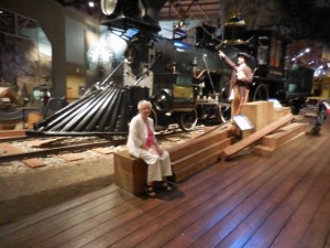
The same rivers that earlier brought death and destruction began to provide increasing levels of transportation and commerce. Both the American and especially Sacramento rivers would be key elements in the economic success of the city. In fact, Sacramento effectively controlled commerce on these rivers, and public works projects were funded though taxes levied on goods unloaded from boats and loaded onto rail cars in the historic Sacramento Rail Yards. Now both rivers are used extensively for recreation. The American River is a 5-mph (8-km/h) waterway for all power boats (including jet-ski and similar craft) (Source Sacramento County Parks & Recreation) and has become an international attraction for rafters and kayaking. The Sacramento River sees many boaters, who can make day trips to nearby sloughs or continue along the Delta to the Bay Area and San Francisco. The Delta King, a paddlewheel steamboat which for eighteen months lay on the bottom of the San Francisco Bay, was refurbished and now boasts a hotel, a restaurant, and two different theaters for nightlife along the Old Sacramento riverfront.
